- Home Page
- Long Distance Walks
- Weaver's Way Walking Trail
The Weaver's Way
The Weaver's Way is one of the most varied and wonderful long distance trails I know in Norfolk.
Covering 61 miles of differing Norfolk landscape, this is a walk that lets you explore so many different interests:
- 15th and 17th century stately homes as well as having the chance to amble through the parklands of these estates
- Appreciate some beautiful round tower church interiors and other churches and ruins
- Walk along wonderfully straight but disused railway lines and platforms
- Walk amongst some of the largest expanses of reedbeds in England and some of the largest areas of open water and grazing marshes in Norfolk
However, I want to let you know straight away that you may encounter cows in a couple of fields, so if you have a complete aversion to this, I would probably suggest another walk. Generally speaking, the cows will move away (or be on the other side of the field), but I know that for some people, this is a complete No No. I had one lady walker who just slowly put her arms up and the cows walked away. It's a personal thing, but would rather you know before reading further!
However, if you like the sound of walking through the estates of two magnificent stately homes and trundling along 2 disused railway lines, there is an option to do this first part and then cut across the county to join the Norfolk Coast Path and finish back at Cromer. Just ask and we can discuss (the cows in the field on the first day give you an option to walk around the field as opposed to the last day where you have no option but to walk through the water meadows).
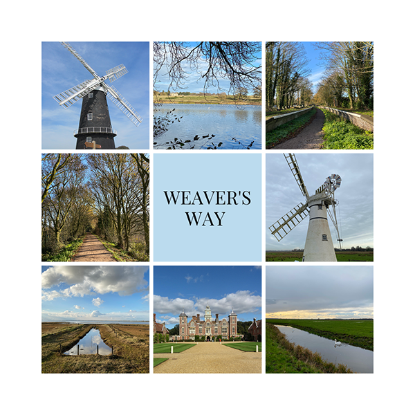
- Follow the Rivers Thurne, Bure and Yare to the estuary at Gt Yarmouth
- Admire some of the remarkable windmills and drainage mills along the trail
- Bypass one of the remotest railway stations in the UK (blink and you’ll miss it!)
- Enjoy some of the incredible panoramic views with windmills, livestock and wildlife all around you

This is a walk that is unique to Norfolk Walking Holidays and one which I can organise for you. It's a walk that not many people will have done, a great chance to share your memories with other fellow walkers!
You’ll find the various walking options below.
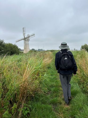
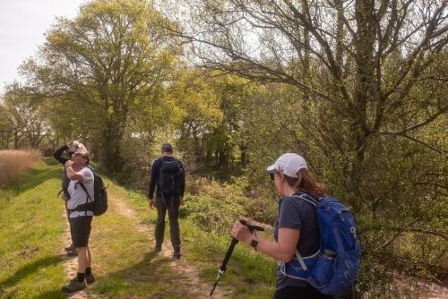
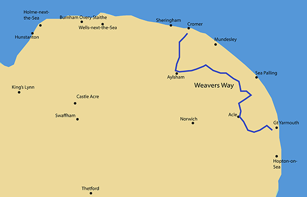
The Weaver's Way Map
This fantastic and fascinating trail starts in the Victorian seaside town of Cromer and winds its way through the most varying Norfolk landscape you can imagine, to finish in another Norfolk seaside town, Gt Yarmouth.
Weaver's Way options
CONTACT DETAILS:
Suzy Watson
+44 (0)7765 668188
suzy@explorenorfolkuk.co.uk
Feel free to contact me and we can discuss further
From the start, you’ll never have a dull moment, there’s always something of interest to see. It’s also nice and flat!
Five minutes into the walk you’ll find yourself walking past a rather imposing Gothic building called Cromer Hall. Then you’ll find yourself in the grounds of the National Trust property of Felbrigg Hall with a beautiful lake.
Tall church towers peek out on the landscape all around you and round tower churches appear out of nowhere.
Another National Trust stately home, Blickling Hall, beckons you, and then you have a lovely long stretch of trail which takes you along a wooded and disused railway line.
Then the scenery dramatically changes and you enter the Norfolk Broads landscape; churches become replaced with windmills which become ever more prominent.
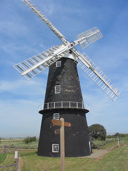 Berney Arms Windmill
Following the Rivers Thurne and Bure, you’ll be surrounded by drainage mills as you criss-cross dykes and grazing meadows to finally arrive at the estuary in Gt Yarmouth.
Why not read a little bit more about what you’ll experience on this Weaver's Way walk here.
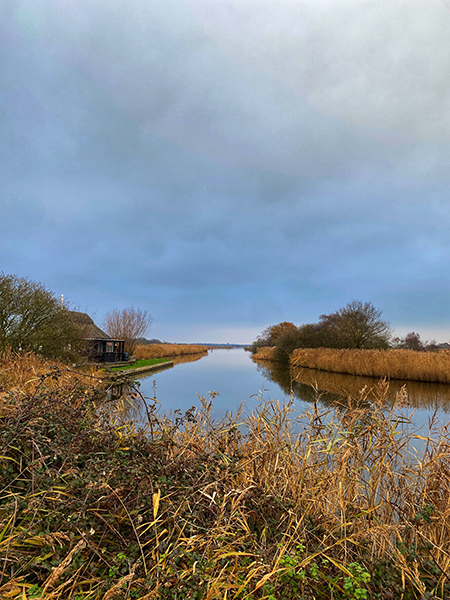
There are 5 options for this walk with differing mileages. Please feel free to contact me with any questions you may have about any of these options. Due to the remoteness of the Broads, it’s a little difficult to alter the mileage and there might also be a couple of taxi transfers in order to get some decent accommodation.
Weaver’s Way Distances
The Weaver’s Way is a 61 mile long distance walk starting on the North Norfolk coast in Cromer and finishing on the east coast of Norfolk at Gt Yarmouth.
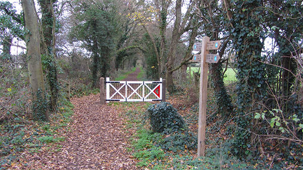
Like all of our long distance trails that we organise for you, this is an official Norfolk Trail so it’s well sign posted all the way, even through the remotest of grazing meadows towards the end of the walk!
What you’ll see on the Weaver's Way
Stately Homes
There are two very impressive stately homes along this trail, both are completely different. Felbrigg Hall has a Jacobean exterior, and although Blickling Hall was built on the original foundations, the present building dates back to the 1600’s.
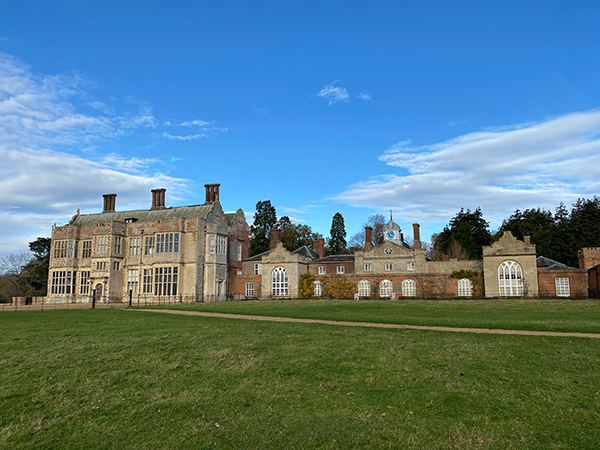 Felbrigg Hall
Both are managed by the National Trust, and this particular walk cuts through the beautiful grounds of both properties. They appear at quite convenient stopping points for either having a bite to eat or just to rest your legs for a little bit.
If you’d like to take a rest day so that you can visit Blickling Hall for a day, we can discuss this at the time of booking.
If you enjoy walking around formal gardens, then Felbrigg Hall has an amazing walled garden, and Blickling Hall also has a wonderfully structured formal garden at the back of the house. Both have orangeries and lakes!
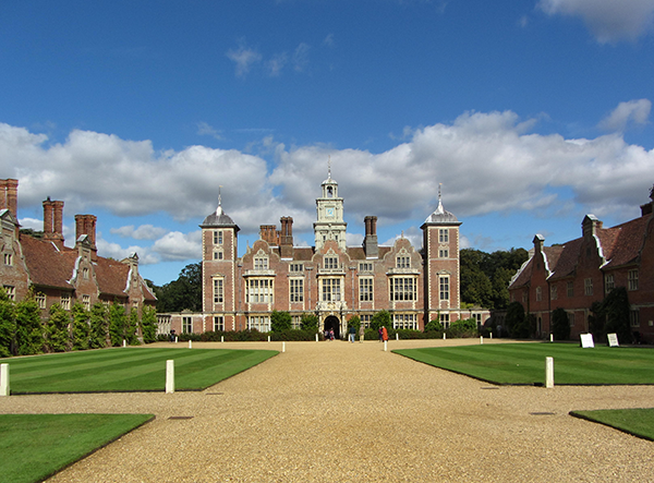 Blickling Hall
Disused railway lines and platforms
There are some wonderful long stretches of disused railway tracks which are extremely pleasant, peaceful and enjoyable.
You can view the options for walking the Weaver's Way here
Back in the day, this railway line was called The Midland and Great Northern Railway and linked the Midlands to the coast and Gt Yarmouth. At one point there were over 80 trains running along here at weekends taking factory workers from the Midlands to the seaside for their holiday breaks. Along with many railway lines in the UK, this one was closed in 1959.
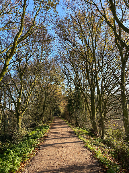
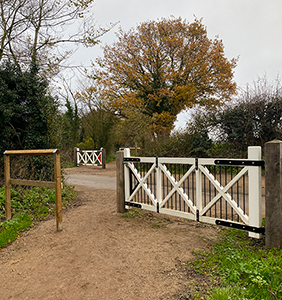
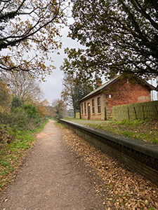
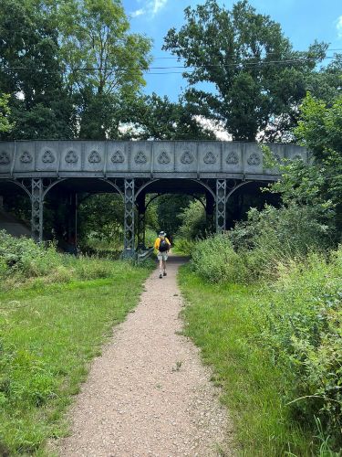
Much of the track bed is enclosed by peaceful wooded landscape or is on high embankments, and you’ll discover two of the platforms which are still intact.
It’s quite a weird sensation arriving at a deserted railway platform!
One station has the foundations of the signal box and the waiting room whilst the other has the old station building which is boarded up. Badger activity is also very evident along some of these stretches with huge holes along some of the embankments!
Replica railway crossing gates are a reminder that you’re walking down an old railway line (if you need a reminder!) and are used as a way of alerting you to the quiet lanes you’ll need to cross.
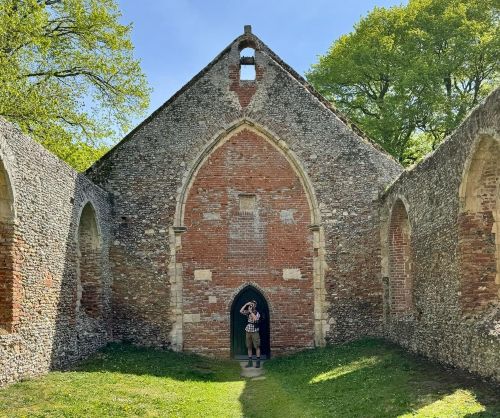
Round Tower churches and other churches
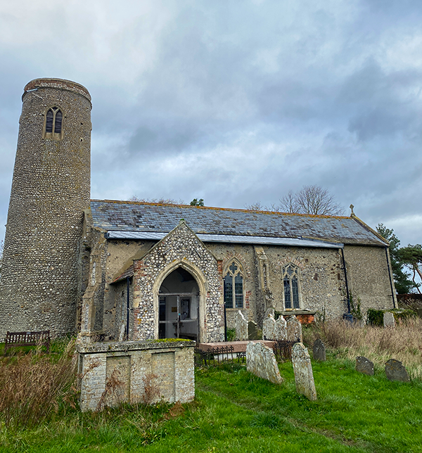 Thwaite round tower church
What you'll really notice on the first half of the walk are the large number of churches that you come across and how prominent they are on the landscape. It had me thinking about how important churches were in society (to some they still are, but I think certainly not as much these days). At one point, as I had a panoramic view in the rolling countryside, I could see three all around me.
Two of Norfolk’s 124 round tower churches are on the Weaver's Way trail too. Both are fairly early on and are definitely worth popping into. They are so wonderfully small.
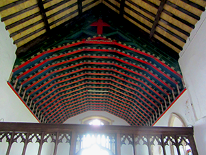
The first is in Sustead which has an amazing roof and the other one, Thwaite round tower church, has beautifully painted organ pipes.
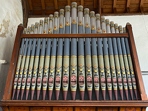
Villages and towns
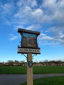
Some of the villages that you amble through are peaceful, quiet villages.
Aldborough has a picturesque green surrounded by Georgian properties (and you’ll come across a few very elegant Georgian properties around Aylsham and North Walsham), whilst Meeting Hill is a quiet and unassuming village with the historic Worstead Baptist church, old fashioned alms houses and again, some pretty Georgian houses (quite why Worstead Baptist church is in this village and not in the village of Worstead, a few miles away, is unknown to me!) However, Worstead does play an important part in Norfolk’s history. This is where the high quality Worstead wool originated in the 12th century and is part of the history of the Weavers Way walk.
Potter Heigham is a very busy riverside town. If you stop here at the end of the day you won’t be staying here. It’s a mecca for Norfolk Broads boating visitors, but it does have a medieval bridge which is quite fascinating, particularly as most boats can't sail under it!
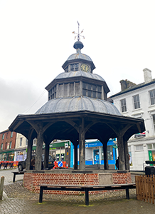
You may also be stopping in North Walsham (depending on which option you choose). This was also an important weaving town in the 12th century. It has a huge church and is actually one of the largest parish churches in the UK and has the ruin of a collapsed tower. The town also has a rather unusual octagonal market cross.
Drainage mills and windmills
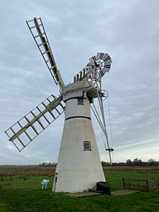
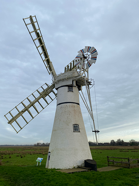 Thurne Windmill
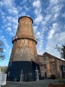
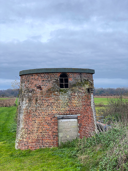
It’s staggering how many windmills and drainage mills you’ll come across during the Weavers Way long distance walk. At one point, towards the end of the walk, I counted 7 all around me! Some are working, others are well restored or being restored whilst others are left as derelict ruins. It's actually quite fun to keep spotting them!
There are some lovely photo opportunities besides these windmills too, particularly at Thurne. Thurne windmill is the only white windmill in the Norfolk Broads and is still working.
They played, and still play an important part in the Norfolk Broads. Their purpose is to pump water from the marshes and meadows into the dykes or the main rivers.
The Norfolk Broads Rivers and Staithes
The first river you encounter is the River Bure which is just outside the grounds of Blickling Hall in the middle of rural countryside. It flows all the way into RSPB Breydon Water which is your finishing point.
However, you don’t follow this particular river all the way.
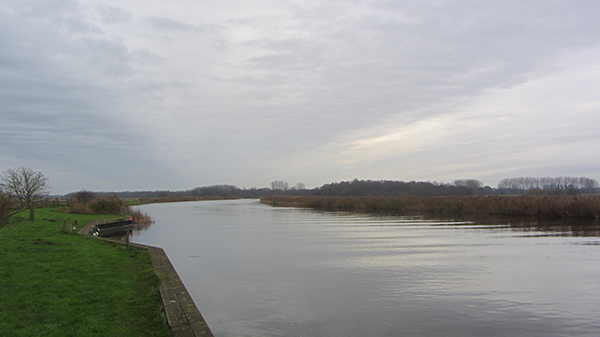
The path then takes you across country to the next river which is the River Thurne in the Broads landscape. This river joins the River Bure further down, so you meet up with it again (!), and then you part company to eventually join the River Yare which again flows into Breydon Water, but at a different entry point from the River Bure.
The second half of this walk is a perfect opportunity to see what the Norfolk Broads really looks and feels like on foot! You'll enjoy the peace and quiet along the high banks of three different rivers, as well as walking along some very typical Norfolk Broads staithes.
Grazing meadows and reedbeds
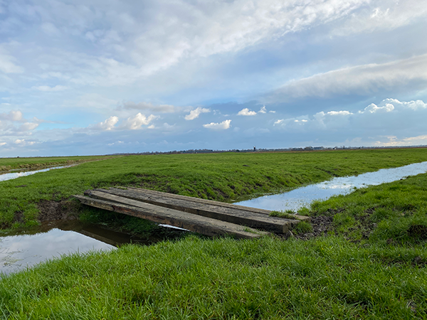
At one point on the walk you’ll discover what it’s like to be completely remote in the middle of the Norfolk grazing meadows and marshland. There really is no form of civilisation around you, but don’t worry, signage is good!
Weavers Way accommodation
Due to the nature of the Broads and the fact that it sometimes means huge detours to reach villages, some of the accommodation along this trail is a little sparse, especially if you want decent accommodation (again, like the Peddars Way) so taxi transfers are needed on some of the options. Many of the stops are in pubs because B&B’s unfortunately seem to be waning.
The history of the Weavers Way
I always think it's good to get an idea of how or why these particular trails exist.
The name of the Weavers Way comes from the cloth industry that was very important around the 12th century in this area.
Norfolk produced some very distinctive course wool fibre that was woven into cloth, and as mentioned above, Worstead gave its name to this high quality wool fabric. You walk right through the village of Worstead. Other historical important weaving towns (along the Weavers Way) were Aylsham, North Walsham, Dilham and Honing.
I really hope that you now have a very good idea of how enjoyable this walk will be.
Personally, I absolutely adored it. I just loved the contrast of walking through stately home parklands to then encounter disused railways and finally to be in amongst the windmills and drainage mills and the wilderness of the marshland and grazing meadows in the Norfolk Broads.
Why not take a look at the available options here, and I’ll look forward to giving you a really enjoyable and unforgettable walk.
CONTACT DETAILS:
Suzy Watson
+44 (0)7765 668188
suzy@explorenorfolkuk.co.uk
Feel free to contact me and we can discuss further
