Norfolk Coast Path Self-Guided Walking Holidays

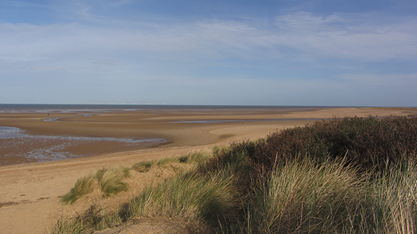
The Norfolk Coast Path is undeniably beautiful, and fairly flat, and this is what makes it such a fantastic trail for a self-guided walking holiday.  

Creeks full of wading birds, water meadows grazed by cows, swathes of golden sand on the beaches, wilderness sand dunes, pretty flint stone villages and so much more, but I wouldn’t want to give it all away! 

You can read a little more about what you might expect to see on this trail here.
Norfolk Coast Path

There is so much to see, and all taken at the slow Norfolk pace of life.  As they say in Norfolk “Slow Ye Down”!

Here at Norfolk Walking Holidays I specialise in organising holidays along trails that are only in Norfolk, and the Norfolk Coast Path is one such path.

What are the Norfolk Coast Path Distances

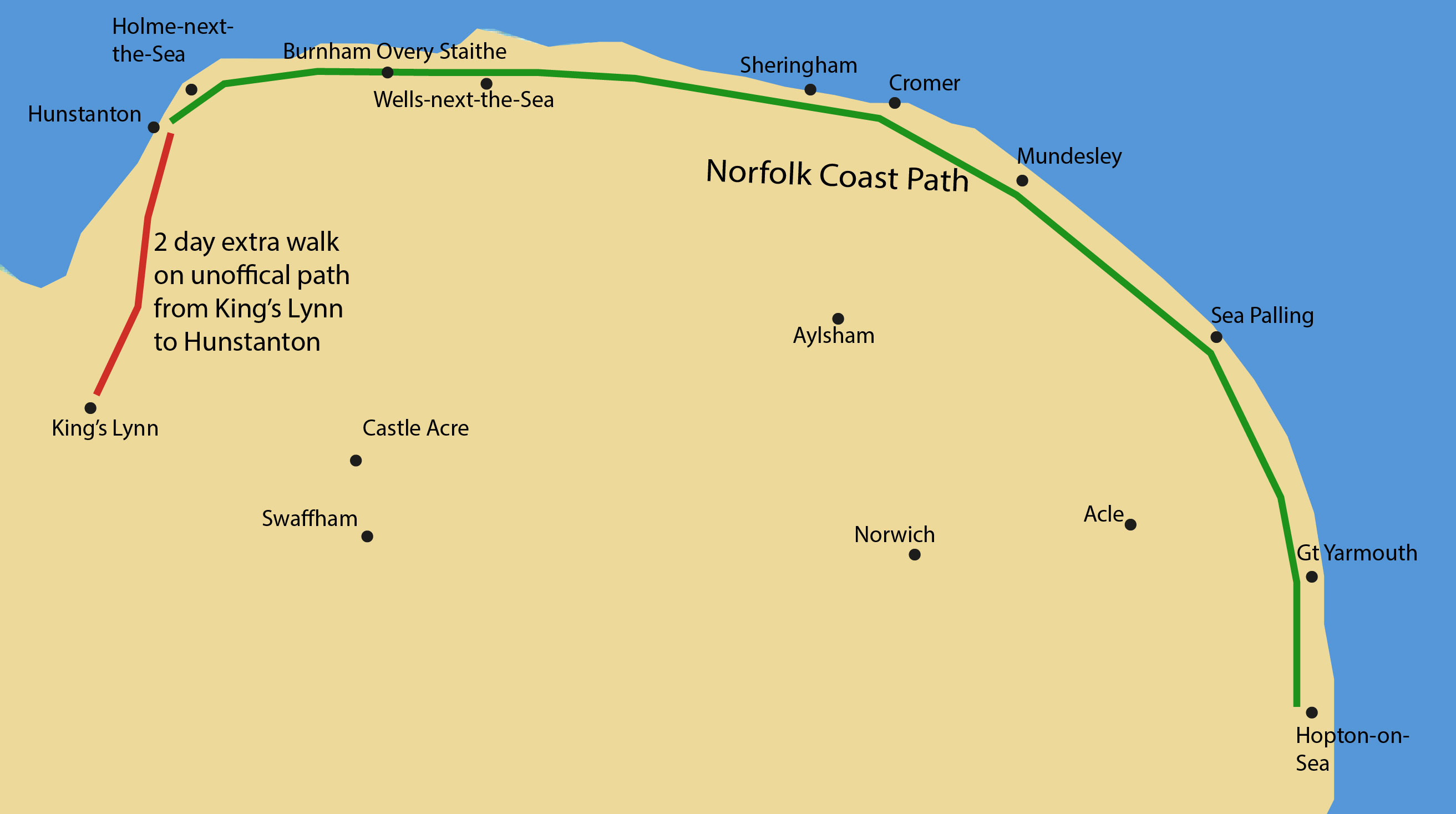
Since 2016 the distance of the Norfolk Coast Path has been 84 miles long and it follows the Norfolk coast all the way from Hunstanton on the west coast to Hopton-on-Sea on the east coast. 

From 2014-2016 the Norfolk Coast Path has had two extensions to make it part of the England Coast Path which should eventually run all the way round the English coast.  Norfolk was actually one of the first counties to be a part of this extension.

Norfolk Coast Path map with addition at King's LynnThe Norfolk Coast Path map

However, don’t be alarmed if you feel you don’t have the capacity to walk the whole 84 miles.  

We have 2 other options (which you can see below); to walk from Hunstanton to Cromer which is 45 miles, or, new for 2023 to walk from King's Lynn to Cromer via Hunstanton, joining the Norfolk Coast Path in Hunstanton.  This is on an unofficial "Norfolk Walking Holidays" route and is 66 miles, and easy to follow.  

CONTACT DETAILS:

Suzy Watson
+44 (0)7765 668188
suzy@norfolkwalkingholidays.com

If you’d like to see what I thought about walking the Norfolk Coast Path, you can read my Norfolk Coast Path blog here which is over on the sister site of Explore Norfolk UK.

I have, of course, walked it many times since and every time I’m just bowled over by the sense of openness you get when walking alongside this wonderful coastline.

Below you can see the walking options that either stop at Cromer or Hopton.

Norfolk Coast Path to Cromer Options

  • The Norfolk Coast Path starts at Hunstanton and, as at 2016, now finishes at Hopton on Sea, right around the east coast of Norfolk. However, these particular trail options end at Cromer, the original finish to the Norfolk Coast Path.

    Distance: 45 miles/72 km from Hunstanton to Cromer, or 66 miles if you choose to walk from King's Lynn.
    Graded: easy to moderate
    Taken from: any time of year, but the best time is between April and October

    This beautiful Norfolk Coast Path trail will leave you with everlasting memories of a coastline that you won’t see anywhere else in the UK. This Norfolk coastline is unique. It’s where huge skies meet vast open landscapes ranging from salt marshes and beaches to cliffs, and at the same time has an abundance of wildlife

    Prices for 2023:
    NCP1 4 nights/3 days walking – from £510 per person (based on 2 sharing)
    NCP2 5 nights/4 days walking – from £627 per person (based on 2 sharing)
    NCP3 6 nights/5 days walking** – from £685 per person (based on 2 sharing)
    NCP4 7 nights 6 days walking (66 miles)*** – from £767 per person (based on 2 sharing).

    **Due to accommodation availability, this walk requires a two night stay in one of the coastal towns and catching the easy Coasthopper bus.

    ***This 6 day walk is new for 2023 and involves an extension along an unofficial "Norfolk Walking Holidays" path from King’s Lynn to Hunstanton taking in the historic quarter of King’s Lynn, the pretty flintstone village of Castle Rising, the Sandringham Estate and RSPB Snettisham reserve. This is 66 miles.

  • Prices for these Norfolk Coast Path walks are based on two people sharing a room. If you are travelling on your own as a solo traveller, or if you are walking in a group but would like a single room, then the additional single supplement of £65 per person per night applies.

    Trail Code: NCP1
    Trail length: 45 miles/72 km
    Trail duration:4 nights/3 days walking,
    Average distance: 15 miles/24 km per day
    Prices from: £510 per person (based on 2 people sharing)
    3 day suggested walking itinerary

    The itineraries can always be altered to suit your needs. It’s always a good idea to have a chat before we go into detail about the walk. That way we can work out exactly what you require for your walking holiday. I also delight in choosing excellent accommodation if that is what you prefer.

    Arrival
    Arrive and stay the night in Hunstanton.

    Day 1
    Walk from Hunstanton to Burnham Overy Staithe (16 miles/24 km)

    Starting at Hunstanton, you’ll get your first glimpse of the Norfolk coast and experience the joys of one of the many nature reserves that you’ll come across. Stroll through two pretty flintstone villages of Thornham and Brancaster, enjoy the boardwalk amongst the Norfolk reeds and the wonderful views over the marshes as you amble along the sea wall from Burnham Deedale to Overy Staithe. You will either stay in Burnham Overy Staithe or catch the bus to Wells-next-the-Sea depending on the type of accommodation you prefer.

    Day 2
    Walk from Burnham Overy Staithe to Blakeney (15 miles/24 km)

    Today you head away from Burnham Overy Staithe walking along the creek towards the beach where the sand dunes part and you have an incredible view of the iconic North Norfolk coast. Swathes of golden sand and huge skies. Hoklham beach and pine forests, Wells-next-the-Sea fishing port and more salt marshes await this stretch as you eventually arrive at Blakeney Quay.

    Day 3
    Walk from Blakeney to Cromer (15 miles/24 km)

    The landscape changes today. A 4 mile hike along shingle adjacent to the Cley nature reserve (there is an alternative to this which I can tell you about) and onto the first of the cliffs along the Norfolk Coast. Heading towards Sheringham you begin to see the rugged nature of coastal erosion. A quick bypass along the promenade at Sheringham brings you up to a Beeston Bump which housed a WWII wireless interceptor station. From here you descend, sometimes amongst the caravan parks (unavoidable), but eventually arrive at the pier in Cromer.

    Book Your 3 Day Walk Here

  • Prices for these Norfolk Coastal Path walks are based on two people sharing a room. If you are travelling on your own as a solo traveller, or if you are walking in a group but would like a single room, then the additional single supplement of £65 per person per night applies.

    Trail Code: NCP2
    Trail length: 45 miles/72 km
    Trail duration: 5 nights, 4 days walking
    Average distance: 11.25 miles/18 km
    Prices from: £627 per person (based on 2 people sharing)

    4 day suggested walking itinerary

    The itineraries can always be altered to suit your needs. It’s always a good idea to have a chat before we go into detail about the walk. That way we can work out exactly what you require for your walking holiday. I also delight in choosing excellent accommodation if that is what you prefer.

    Arrival
    Arrive and stay the night in Hunstanton.

    Day 1
    Walk from Hunstanton to Brancaster Staithe (11 miles/17.7 km)

    Starting at Hunstanton, you’ll get your first glimpse of the Norfolk coast and experience the joys of one of the many nature reserves that you’ll come across. Stroll through two pretty flintstone villages of Thornham and Brancaster, enjoy the boardwalk amongst the Norfolk reeds towards Brancaster Staithe.

    Day 2
    Walk from Brancaster Staithe to Wells-next-the-Sea (11 miles/17.7 km)

    You’ll enjoy wonderful views over the marshes as you amble along the sea wall from Burnham Deedale to Overy Staithe. You head away from Burnham Overy Staithe walking along the creek towards the beach. Here the sand dunes part and you have an incredible view of the iconic North Norfolk coast. Swathes of golden sand and huge skies. Hoklham beach and pine forests and Wells-next-the-Sea fishing port awaits your arrival!


    Day 3
    Walk from Wells-next-the-Sea to Blakeney (just under 8 miles/12.5 km) or Cley (11 miles/17.7 km)

    Today you’ll experience yet more salt marshes, maybe take a break at Morston Quay to admire the wonderful view along the creek and then resume your walk to Blakeney (or continue on to Cley).

    Day 4
    Walk from Blakeney (or Cley) to Cromer (15 miles/24.1 km (or 13 miles/21 km)

    The landscape changes today. A 4 mile hike along shingle adjacent to the Cley nature reserve (there is an alternative to this which I can tell you about) and onto the first of the cliffs along the Norfolk Coast. Heading towards Sheringham you begin to see the rugged nature of coastal erosion. A quick bypass along the promenade at Sheringham brings you up to Beeston Bump which housed a WWII wireless interceptor station. From here you descend, sometimes amongst the caravan parks, but eventually arrive at the pier in Cromer.

    Book Your 4 Day Walk Here

  • Our prices for the Norfolk Coast Path walk are based on two people sharing a room. If you are travelling on your own as a solo traveller, or if you are walking in a group but would like a single room, then the additional single supplement of £55 per person per night applies.

    Trail Code: NCP3
    Trail length: 45 miles/72 km
    Trail duration: 6 nights, 5 days walking
    Average distance: 9 miles/14.5 km per day
    Prices from: £686 per person (based on 2 people sharing)

    This walk requires a two night stay in one of the coastal towns and catching the Coasthopper bus (easy to use and regular).

    5 day suggested walking itinerary

    Don’t forget that the itineraries can always be altered to suit your needs. It’s always a good idea to have a chat before we go into detail about the walk. That way we can work out exactly what you require for your walking holiday. I also delight in choosing excellent accommodation if that is what you prefer.

    Arrival
    Arrive and stay the night in Hunstanton.

    Day 1
    Walk from Hunstanton to Brancaster Staithe (11 miles/17.7 km)

    Starting at Hunstanton, you’ll get your first glimpse of the Norfolk coast and experience the joys of one of the many nature reserves that you’ll come across. Stroll through two pretty flintstone villages of Thornham and Brancaster, enjoy the boardwalk amongst the Norfolk reeds towards Brancaster Staithe.

    Day 2
    Walk from Brancaster Staithe to Wells-next-the-Sea (11 miles/17.7 km)

    You’ll enjoy wonderful views over the marshes as you amble along the sea wall from Burnham Deedale to Overy Staithe. You head away from Burnham Overy Staithe walking along the creek towards the beach. Here the sand dunes part and you have an incredible view of the iconic North Norfolk coast. Swathes of golden sand and huge skies. Hoklham beach and pine forests and Wells-next-the-Sea fishing port awaits your arrival!

    Day 3
    Walk from Wells to Blakeney (just under 8 miles/12.5 km)

    Today you’ll experience yet more salt marshes, maybe take a break at Morston Quay to admire the wonderful view along the creek and then resume your walk to Blakeney.

    Day 4
    Walk from Blakeney to Weybourne (7.5 miles/12 km)

    The landscape changes today. A stretch of sea wall brings you into the pretty flintstone village of Cley. Then a 4 mile hike along shingle adjacent to the Cley nature until you reach the cliffs at Weybourne. Here you head inland to catch the bus to Cromer or Blakeney (depending on what we have organised together).

    Day 5
    Walk from Weybourne to Cromer (7.5 miles/12 km)

    Starting out today on the first of the cliffs along the Norfolk Coast. Heading towards Sheringham you begin to see the rugged nature of coastal erosion. A quick bypass along the promenade at Sheringham brings you up to Beeston Bump which housed a WWII wireless interceptor station. From here you descend, sometimes amongst the caravan parks (unavoidable), but eventually arrive at the pier in Cromer

    Book Your 5 Day Walk Here

  • This is a new walk for 2023 and adds 2 walking days prior to reaching the start of the official Norfolk Coast Path at Hunstanton. You are provided with detailed guided walk notes from King's Lynn to Hunstanton.

    Our prices for the Norfolk Coast Path walks are based on two people sharing a room. If you are travelling on your own as a solo traveller, or if you are walking in a group but would like a single room, then the additional single supplement of £65 per person per night applies.

    Trail Code: NCP4
    Trail length: 66 miles
    Trail duration: 6 days walking, 7 night’s accommodation
    Average miles:11.25 miles/18.1km
    Prices from: £767 per person (based on 2 people sharing)

    Book Here

    Suggested Itinerary for the 6 Day walk

    All the suggested itineraries for the Norfolk Coast Path walk can be amended to your requirements. I am very happy to chat to you to find out if you have any particular places you would like to stay in or visit which would require different overnight stays and to discuss your budget as the accommodation can vary according to your requirements.

    Arrival
    Arrive and stay at your accommodation overlooking the quay and situated in the historic quarter of King’s Lynn (arrival by train is preferable as parking in King’s Lynn for the duration of the walk is tricky, although you can use the Just Park app which does have various houses you can leave your car at for as long as you want).

    Day 1
    Walk from King’s Lynn to Dersingham (10.2 miles/16.4 km)
    Walk through the historic quarter of King’s Lynn passing numerous historic buildings and ruins and continuing along the old disused railway line which is paved. Out of King’s Lynn you arrive in another historic village called Castle Rising and on to the royal Sandringham Estate woodlands, eventually arriving in Dersingham.

    Day 2
    Walk from Dersingham to Hunstanton (10 miles/16 km)
    A short walk through Dersingham village to arrive at farm tracks which take you all the way to the renowned RSPB Snettisham bird reserve. From here you walk along the beach and promenades all the way to Hunstanton.

    Day 3
    Walk from Hunstanton to Brancaster (10 miles/16km)
    This is a beautiful walk along the Old Hunstanton golf course, the sand dunes and then over to Holme Nature Reserve, along board walks, through pine forests and onto the sea defence bank towards Thornham. The next stretch of the Norfolk Coast Path takes you away from the coast bypassing Titchwell and arriving back at Brancaster.

    Day 4
    Walk from Brancaster to Wells-next-the-Sea (12.5 miles/20.1 km)
    From Brancaster you take a board walk hugging the marshes towards Brancaster Staithe. You have glorious views over the marshes out towards the sand dunes and arriving at Gun Hill. This next stretch of the Norfolk Coast Path takes in the well-known and beautiful Holkham beach and continues on to your destination of the very popular working fishing port of Wells-next-the-Sea.


    Day 5
    Walk from Wells-next-the-Sea to Cley (10 miles/16.09 km)
    Heading through more wonderful salt marshes with incredible views towards Blakeney Point, and a few sea defences and marshes later you reach the quay in the pretty village of Blakeney and continue on to Cley.

    Day 6
    Walk from Cley to Cromer (13 miles/21km)
    A very different day today on the Norfolk Coast Path. Heading on past Cley windmill and Cley Nature Reserve, a large chunk of this walk is shingle. It can be hard going, but the landscape and the feeling of remoteness is very different to what you will have seen so far. The landscape changes dramatically from the beginning of the day’s walk to the end. You eventually walk on the cliff tops from Weybourne to Sheringham and then enter developments in the form of West Runton and East Runton static caravan parks. You enter Cromer on the cliff face looking down on the Pier and feel a great sense of achievement!

    Book Your 6 Day Walk Here

  • I really want you to have the best walking experience you can have, and for me that means it’s important to find decent accommodation. Fortunately, most of the accommodation on the Norfolk Coast Path is excellent, but there are still some that I cross of the list if I just don’t like the atmosphere or the ambience of the room or the pub/hotel.

    Everyone is different and everyone’s needs are different. I like to listen and to make sure that you are happy with what I am offering. In the process of booking, I will often send you links of the accommodation for peace of mind. I respect the fact that you are on holiday and you want the best for you.

    I have visited all of the places where you would be staying and met with the owners or managers so I know exactly what they are like. They are all extremely friendly and hospitable! Nothing is too much trouble and most of them go out of their way to give you a great stay.

    Most of the accommodation is on the path, but there are possibly a few where you will need to take a short detour. I can arrange for B&B accommodation or pubs or hotels. In some villages accommodation is scarce so you have to use a pub.

    You may also have to take the excellent coasthopper bus where accommodation is not available, such as in the village of Cley. This is all explained at the time of booking.

    It’s very helpful, when booking, to let me know if you prefer pubs to B&B’s. Most of the time it is a mixture of the two, but I can arrange for the accommodation to be pubs only should you require.

  • Included:
    Bed and breakfast accommodation in either a B&B or a pub, dependent on availability and your personal preferences.
    Luggage transfer from place to place
    Your holiday pack which includes a very detailed itinerary including places of interest, lunch stops and details of the accommodation providers, how to reach them etc, an excellent guidebook, and the A to Z OS booklet which maps out the path.
    Emergency contact details for me in the event of a problem.

    Excluded:
    Lunches, dinners, snacks and drinks.
    Travel Insurance – please make sure you have travel insurance to cover this holiday.
    Transport for any rest days. We will be happy to book you taxis should you require.
    Travel to/from Hunstanton and to/from Cromer.
    Rest days -any costs for rest days or extra activities undertaken.

    Extras:
    Any additional nights used other than on this itinerary (such as rest days, any additional days at the beginning or end of the walk for your own personal holiday not covered by the itinerary).
    Rest days - suggest you add on approximately £65 per person per night.
    Solo walker and single walker supplements - please add on approximately £65 per night to cover the cost of single occupancy, maps and guidebooks for one, and baggage transfers for one

  • All details about how to arrive at your B&B or pub will be in the information pack that is sent out to you prior to your walk, whether you are arriving by car or bus.

    Arrival:

    By Road:
    Hunstanton is located in West Norfolk, 30 minutes north of King’s Lynn on the main coastal road of the A149.
    Cromer is located on the North Norfolk Coast approximately 45 minutes north of Norwich on the A140/A149.

    Car parking:
    There is usually parking at your accommodation for the duration of your walk. However, there may be times when I need to ask a pub if you can park in their car park whilst walking.

    By Rail:
    To/from Hunstanton: The nearest train station to Hunstanton is King’s Lynn (Great Northern network and has direct lines into and out of London Kings Cross)
    To/from Cromer: Cromer railway station (Abellio Greater Anglia network). Trains run to and from Norwich. To reach London you would need to change at Norwich for onward travel.

    By Bus:
    The local bus service runs from King’s Lynn to Wells is serviced by Lynx No 36 (https://www.lynxbus.co.uk/bus-times-fares/) and then from Wells to Cromer on CH4 (https://www.sanderscoaches.com/copy-of-5-north-walsham---holt).
    Norfolk Green bus service No 10. And 11 also run from King’s Lynn to Hunstanton. (http://www.norfolkgreen.co.uk/services)

    By Air:
    The nearest airport is London Stansted Airport.

  • If you would like to take an extra day or two as a rest day, please just let me know when you book. We can chat about ideas. As I live in Norfolk, I have a good idea of what there is to see and whether it’s worth visiting! It’s also a great way to see a little extra other than the walking trail! Some choose to take a rest day in the middle of the walk, others at the end or beginning. I’m also happy to organise an onward journey to Norwich if required.


    Please just ask me and we can chat about it.


Norfolk Coast Path to Hopton-on-Sea Options

  • The Peddars Way and Norfolk Coast Path and two very different trails. The Peddars Way is part of an old Roman Road and once used by pilgrims on their way to the religious shrine at Walsingham. It takes you through an assortment of woodlands, alongside open fields and dead straight tracks. You pass a wonderful priory ruin and some ancient burial grounds! The Norfolk Coast Path gives you the huge Norfolk skies which fall against the flat horizon. With the wildlife, salt marshes, creeks and water meadows to golden beaches and walks along the cliff tops, this is a truly wonderful coastal experience. This particular option ends in Hopton-on-Sea.

    Trail length: 130 miles/209 km from Knettishall Heath to Hopton
    Graded: easy to moderate
    Open from: April to October

    Prices for 2023:
    NCP8 - 7 days walking – from £894 per person (based on 2 sharing)

  • Prices for these Norfolk Coastal Path walks are based on two people sharing a room. If you are travelling on your own as a solo traveller, or if you are walking in a group but would like a single room, then the additional single supplement of £65 per person per night applies.

    Trail Code: NCPPW5
    Trail length: 130 miles/209 km
    Trail duration: 8 night’s accommodation, 7 days walking
    Average miles: 12.5 miles/20.1 km per day
    Prices from: £894 per person

    7 day suggested walking itinerary


    Arrival
    Arrive in Norfolk and stay in a B&B

    Day 1
    Walk from Hunstanton to Brancaster Staithe (11.5 miles/17.7 km)

    Starting at Hunstanton, you’ll get your first glimpse of the Norfolk coast and experience the joys of one of the many nature reserves that you’ll come across. Stroll through two pretty flintstone villages of Thornham and Brancaster, enjoy the boardwalk amongst the Norfolk reeds towards Brancaster Staithe.

    Day 2
    Walk from Brancaster Staithe to Wells-next-the-Sea (11.5 miles/17.7 km)

    You’ll enjoy wonderful views over the marshes as you amble along the sea wall from Burnham Deepdale to Overy Staithe. You head away from Burnham Overy Staithe walking along the creek towards the beach. Here the sand dunes part and you have an incredible view of the iconic North Norfolk coast. Swathes of golden sand and huge skies. Hoklham beach and pine forests and Wells-next-the-Sea fishing port awaits your arrival!

    Day 3
    Walk from Wells-next-the-Sea to Cley (10 miles/17.7 km)

    Today you’ll experience yet more salt marshes, maybe take a break at Morston Quay to admire the wonderful view along the creek and then resume your walk to Blakeney and on to Cley.

    Day 4
    Walk from Cley to Cromer (13 miles/21 km)

    The landscape changes today. A 4 mile hike along shingle adjacent to the Cley nature reserve (there is an alternative to this which I can tell you about) and onto the first of the cliffs along the Norfolk Coast. Heading towards Sheringham you begin to see the rugged nature of coastal erosion. A quick bypass along the promenade at Sheringham brings you up to Beeston Bump which was an old WWII wireless interceptor station. From here you descend, sometimes amongst the caravan parks (unavoidable), but eventually arrive at the pier in Cromer

    Day 5
    Walk from Cromer to Happisburgh (14 miles/22.5 km)

    After a lovely stretch on the beach to Overstrand and walking through a little part of the village, the path eventually you onto the cliff tops with amazing views down to the beaches below. Coastal erosion is very evident along the cliffs at Trimingham. From Mundesley you walk along the beach below the eroding cliffs and eventually end up on top of the cliff heading towards Happisburgh where you'll see the red and white lighthouse in the distance.

    Day 6
    Walk from Happisburgh to Winterton (11 miles/17.7 km)

    Having hopefully spent some time admiring the lighthouse, the path takes you towards Sea Palling which is heralded by the man-made reefs just out to sea and the golden sand and calm waters. From here you walk behind the sand dunes of Horsey beach where you may pop up to the top to see if you can see any seals! Once past here you will be taken through a Special Site of Scientific Interest and onto the wilderness of Winterton Dunes.

    Day 7
    Walk from Winterton to Hopton (14 miles/22.5 km)

    From the pretty valley floor at Winterton, you skirt the busy town of Hemsby and then head on, walking below the cliffs and on the beaches until you arrive in the middle of Gt Yarmouth. A quick glimpse of the historic quarter breaks up the walk through the town and eventually you experience more peace once through Gorleston and on to the end of the walk at Hopton-on-Sea.

    Book 7 day Walk Now

  • I really want you to have the best walking experience you can have, and for me that means it’s important to find decent accommodation. The availability of accommodation on the Peddars Way is a little sparce, but once onto the the Norfolk Coast Path there is more choice.

    Everyone is different and everyone’s needs are different. I like to listen and to make sure that you are happy with what I am offering. In the process of booking, I may send you links of the accommodation. I respect that fact that you are on holiday and you want the best for you.

    Most of the accommodation is on the path, but there are possibly a few where you will need to take a short detour, particularly on the Peddars Way.

    You may also have to take the easy-to-use Coasthopper bus on the Norfolk Coast Path where accommodation is not available, such as in the village of Cley. This is all explained at the time of booking.

    It’s very helpful, when booking, to let me know if you prefer pubs to B&B’s, but sometimes there is no choice!

  • Included:
    Bed and breakfast accommodation in either a B&B or a pub, dependent on availability and your personal preferences.
    Luggage transfer from place to place
    Taxi transfers to the start of the Peddars Way, and to accommodation along the Peddars way, as well as from Hopton at the end of the trail to your accommodation at Gt Yarmouth.
    Your holiday pack which includes a very detailed itinerary which includes places of interest, lunch stops and details of the accommodation providers, how to reach them etc, an excellent guidebook, and the "A to Z" OS booklet which maps out the path.
    Emergency contact details for me in the event of a problem.


    Excluded:
    Lunches, dinners, snacks and drinks.
    Travel Insurance – please make sure you have travel insurance to cover this holiday.
    Transport for any rest days. We will be happy to book you taxis should you require.
    Travel to/from Thetford/Hunstanton and to/from Cromer/Gt Yarmouth.
    Rest days -any costs for rest days or extra activities undertaken.

    Extras:
    Additional nights used other than on this walking itinerary (e.g. rest days, any additional days at the beginning or end of the walk for your own personal holiday not covered by the itinerary).
    Rest days - suggest you add on approximately £65 per person per night.
    Solo walker and single walker supplements - please add on approximately £65 per night to cover the cost of single occupancy, maps and guidebooks for one, and baggage transfers for one.

  • All details about how to arrive at your B&B or pub will be in the information pack that is sent out to you prior to your walk, whether you are arriving by car or public transport.


    By Road:
    Thetford is reached by road via the A11 or the A134.
    Hunstanton is located in West Norfolk, 30 minutes north of King’s Lynn on the main coastal road of the A149.
    Cromer is located on the North Norfolk Coast approximately 45 minutes north of Norwich on the A140/A149.

    Car parking:
    There is usually parking at your accommodation for the duration of your walk. However, there may be times when I need to ask a pub if you can park in their car park whilst walking.

    By Rail:
    To/from Thetford: Thetford railway station served is by the Southern network. Trains run to and from Cambridge/Norwich and Ely.
    To/from Hunstanton: The nearest train station to Hunstanton is King’s Lynn (Great Northern network and has direct lines into and out of London Kings Cross
    To/from Cromer: Cromer railway station (Abellio Greater Anglia network). Trains run to and from Norwich. To reach London you would need to change at Norwich for onward travel.

    By Bus:
    The local bus service runs from King’s Lynn to Wells serviced by Lynx No 36 (https://www.lynxbus.co.uk/bus-times-fares/) and then from Wells to Cromer on CH4 (https://www.sanderscoaches.com/copy-of-5-north-walsham---holt).
    Norfolk Green bus service No 10. And 11 also run from King’s Lynn to Hunstanton. (http://www.norfolkgreen.co.uk/services)

    By Air:
    The nearest airport is London Stansted Airport.

  • If you would like to take an extra day or two as a rest day, please just let me know when you book. We can chat about ideas. As I live in Norfolk, I have a good idea of what there is to see and whether it’s worth visiting! It’s also a great way to see a little extra other than the walking trail! Some choose to take a rest day in the middle of the walk, others at the end or beginning. I’m also happy to organise for an onward journey to Norwich if required.


    Please just ask me and we can chat about it.


What you might see on the Norfolk Coast Path

If you still need persuading about whether you should try this fantastic walk, let me lead you on a journey which will give you an idea of what you might expect to see. 

I really want to show you that the Norfolk Coast Path will be very different to any other walk you will have done before. 

Where sky meets sea
Holkham beach

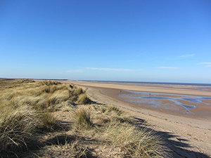
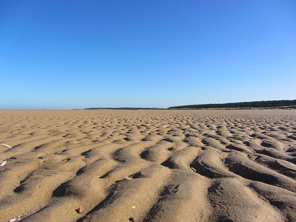
This is what Norfolk is known for.  Where the sky meets the sea, and I know you’ll get to see this on this Norfolk Coast Path walk.  This really comes to the fore at Holme-next-the-Sea, Burnham Overy Staithe and Holkham beach.  

The Norfolk salt marshes and creeks

The creeks on the Norfolk Coast Path

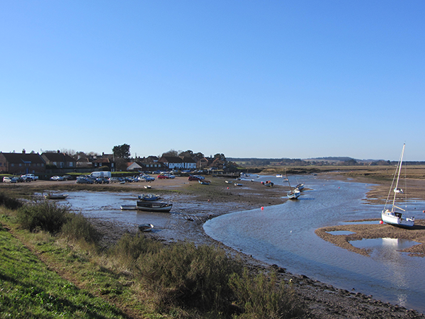
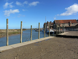
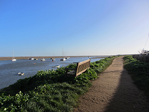
Many of the small villages along the Norfolk coast used to be busy ports, but over time the land has silted up and the creeks become ever smaller, meaning the villages are no longer used as important ports. 

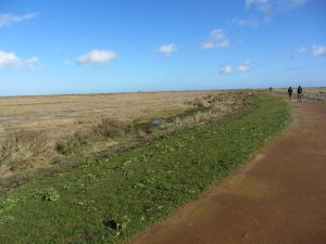
The good news is that the Norfolk Coast Path takes you alongside many of these creeks and salt marshes and the wildlife along these stretches is extraordinary, especially when the tide is out. 

areas of Outstanding Natural Beauty

Three quarters of the Norfolk coast is designated as an Area of Outstanding Natural Beauty, and these walks take you right through these beautiful areas. 

Much of the Norfolk Coast Path from Hunstanton actually falls under this ANOB, and the salt marshes, dunes, grazing meadows and marshland that you walk along make up most of this designated area.

Can I walk The Peddars Way and Norfolk Coast Path combined?

Yes, you can of course walk the whole long distance trail of the Peddars Way and the Norfolk Coast Path.  You'll find details here.

A short video of the 1st stretch of the path

I spent a little bit of time videoing the first stretch of the Norfolk Coast Path from Hunstanton to Thornham.  This will give you a really good idea of what some of the path will be like.  I hope you enjoy it!

Wildlife along the Norfolk Coast Path

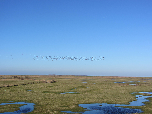
Much of the trail from Hunstanton to Cley is a haven for wading birds and the noises from the oyster catches, red shank, curlews and terns (to name just a few) are magical.
Norfolk's wildlife

And if you are lucky enough to hear and see the geese flying over, that is an extra bonus.  The honking noise from these birds is something to behold!

Norfolk’s fishing trade

Fishing boats at Cromer

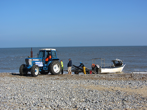
Fishing in Norfolk is an incredibly important livelihood.  You’ll see evidence of this along the Norfolk Coast Path at the Brancaster mussel grading pools, in Wells-next-the-Sea, on Weybourne, Cley and Cromer beach where tractors on the beach are the norm.  You may even get to see them pulling in the boats after a days fishing.

Coastal erosion
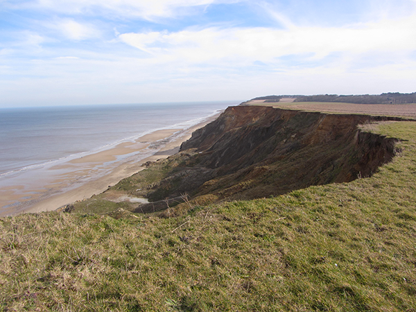
Coastal erosion on the Norfolk Coast Path

Another important factor on the Norfolk coastline is the erosion. 

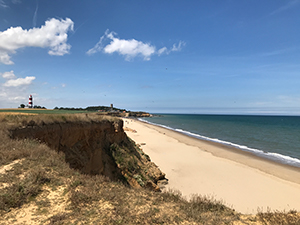
Everyone always thinks Norfolk is flat, but we do indeed have cliffs!  And they are being eroded away very quickly.  Year on year the storms batter the cliff face and rocks end up crumbling down to the beach. 

You will definitely see this from Weybourne to Cromer, and if you walk the whole of the Norfolk Coast Path you will also see this from Cromer onwards.  Much is being done to help stop the erosion and in 2019 there was a huge sandscaping project at Bacton which you will again see, by the build up of sand on the beach.  

War relics
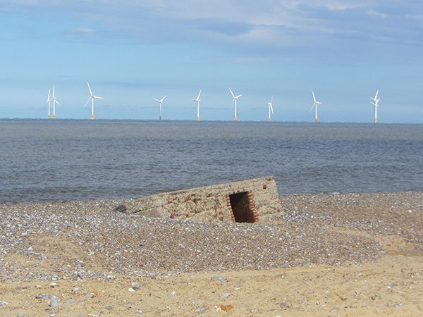
Caister pill box

There are lots of WWII relics along the Norfolk Coast Path, many of which you’ll find fascinating. 

Norfolk obviously played a large part in the war against invasion, and you’ll come across lots of pill boxes, an unusual gun turret (right on the path) and you walk up to a point in Norfolk which was used as a wireless interceptor station, so lots to keep you occupied!

You can see a very short video (18 seconds) of this gun turret on the coastal path.


If you thought the Norfolk Coast Path would just be a flat but coastal walk, I hope I’ve managed to show you that it’s something very different.  I passionately love this coastline and this walk, and hope that you might take the opportunity to chat to me and decide to come and walk it as well.

OR

CONTACT DETAILS:

Suzy Watson
+44 (0)7765 668188
suzy@norfolkwalkingholidays.com

Other Long Distance Walks